

Russian Topo Maps Pro
แผนที่ภูมิประเทศทั่วโลก - การใช้งานออฟไลน์!
ข้อมูลแอพ


คำอธิบายแอพ
การวิเคราะห์แอพ Android และการทบทวน: Russian Topo Maps Pro พัฒนาโดย ATLOGIS Geoinformatics GmbH & Co. KG จดทะเบียนในหมวดหมู่ แผนที่และการนำทาง เวอร์ชันปัจจุบันคือ 7.8.1 อัปเดตเมื่อ 21/05/2025 ตามความเห็นของผู้ใช้ใน Google Play: Russian Topo Maps Pro ได้รับการติดตั้งมากกว่า 79 พัน ปัจจุบัน Russian Topo Maps Pro มีรีวิว 8 พัน คะแนนเฉลี่ย 5.0 ดาว
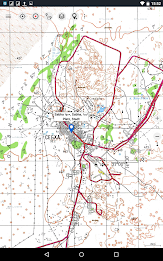
แอพนำทางออฟโร้ดพร้อมแผนที่ภูมิประเทศทั่วโลก (แผนที่พนักงานทั่วไปของรัสเซียเป็นหลัก) นอกจากนี้ยังมีเลเยอร์แผนที่อื่นๆ อีกมากมายที่มีแผนที่หรือภาพถ่ายทางอากาศที่ละเอียดและทันสมัยแม้ว่าแผนที่รัสเซียส่วนใหญ่มีอายุย้อนกลับไปในทศวรรษ 1980 แต่ก็ยังคงเป็นแผนที่โทโปที่ดีที่สุดสำหรับหลายภูมิภาคในแอฟริกาและเอเชีย โดยเฉพาะอย่างยิ่งหากคุณกำลังมองหาเส้นทางระยะไกลหรือโครงสร้างพื้นฐานเก่า แผนที่ทั้งหมดมีป้ายกำกับเป็นภาษาอังกฤษด้วย
สามารถดาวน์โหลดข้อมูลแผนที่เพื่อให้แอพพลิเคชั่นสามารถใช้งานได้โดยไม่ต้องรับสัญญาณอินเทอร์เน็ต แอปไม่มีการรวบรวมข้อมูลผู้ใช้!
เลเยอร์แผนที่ที่เลือกได้ (ทั่วโลก):
• แผนที่ Topo (ครอบคลุมทั่วโลก 1:100,000 - 1:200,000) แผนที่เจ้าหน้าที่ทั่วไปของรัสเซีย - Genshtab
• GGC Gosgiscentr Topo แผนที่รัสเซีย 1:25,000 - 1:200,000
• ROSREESTR บริการของรัฐบาลกลางสำหรับการลงทะเบียนของรัฐ สำนักงานที่ดิน และการทำแผนที่ (เฉพาะรัสเซีย ทันสมัยและมีรายละเอียดมาก)
• แผนที่ Yandex: ภาพถ่ายดาวเทียม แผนที่ถนน (ใช้ออนไลน์เท่านั้น!)
• Openstreetmap: แผนที่ที่ยอดเยี่ยมที่มีสไตล์ที่แตกต่างกัน เช่นเดียวกับการแรเงาและเส้นชั้นความสูง): OSM Topo, OSM Cycle Map (โดยเฉพาะสำหรับนักปั่นจักรยาน), OSM Outdoors (สำหรับนักเดินป่า), OSM Landscape
• Google Maps: ภาพถ่ายดาวเทียม แผนที่ถนนและภูมิประเทศ (ใช้ออนไลน์เท่านั้น!)
• Bing Maps: ภาพถ่ายดาวเทียมและแผนที่ถนน (ใช้ออนไลน์เท่านั้น!)
• แผนที่ ESRI: ภาพถ่ายดาวเทียม แผนที่ถนนและภูมิประเทศ
แผนที่ทั้งหมดสามารถสร้างเป็นภาพซ้อนทับและเปรียบเทียบกันโดยใช้แถบเลื่อนโปร่งใส
โอเวอร์เลย์แบบสลับได้ (ทั่วโลก):
• เนินเขา
• เส้นชั้นความสูง 20 ม
- โอเพ่นซีแมป
แอพนี้นำเสนอฟังก์ชั่นทั้งหมดสำหรับการนำทางกลางแจ้งที่ครอบคลุม:
• ดาวน์โหลดแผนที่สำหรับการทำงานแบบออฟไลน์ (ยกเว้น Google, Bing และ Yandex Maps)
• สร้างจุดอ้างอิง
•การนำทางจุดอ้างอิง GoTo
• สร้างและนำทางเส้นทาง (พร้อมการคำนวณเส้นทางอัตโนมัติตาม OpenStreetMaps)
• การบันทึกเส้นทาง (การประเมินด้วยโปรไฟล์ความเร็วและระดับความสูง)
• ช่องข้อมูลที่กำหนดค่าได้อย่างอิสระในมุมมองแผนที่ (เช่น ความเร็ว ระดับความสูง)
• Tripmaster พร้อมช่องข้อมูลกิโลเมตร เฉลี่ย ระยะทาง เข็มทิศ ฯลฯ รายวัน
• ส่งออกนำเข้า GPX/KML/KMZ
• ฟังก์ชั่นการค้นหา (สถานที่, POI, ชื่อถนน)
• การแชร์เวย์พอยท์/แทร็ก (ผ่านอีเมล, WhatsApp, ...)
• การวัดเส้นทางและพื้นที่
• UMTS/MGRS กริด
แผนที่อื่นๆ สามารถนำเข้าได้ในรูปแบบทั่วไป:
• GeoPDF
• จีโอทิฟ
• MBTiles
• โอซี่ (Oziexplorer OZF2 และ OZF3)
• บริการแผนที่ออนไลน์สามารถรวมเป็นเซิร์ฟเวอร์ WMS หรือเซิร์ฟเวอร์ไทล์ XYZ
• สามารถดาวน์โหลดแผนที่ OpenStreetMap ได้ทีละประเทศในรูปแบบเวกเตอร์ที่ประหยัดพื้นที่!
หากมีคำถามโปรดติดต่อ [email protected]
มีอะไรใหม่
・Support for shapes: Display shapes from shape, gejson or kml/kmz files
・Android 15 support
・Bug fixes & Improvements
・Android 15 support
・Bug fixes & Improvements
ให้คะแนนและตรวจสอบใน Google Play Store
จำนวนการให้คะแนนทั้งหมด
จำนวนผู้ใช้ที่ใช้งานทั้งหมดที่ได้รับการจัดอันดับ: Russian Topo Maps Proจำนวนการติดตั้งทั้งหมด (*โดยประมาณ)
การประมาณจำนวนการติดตั้งทั้งหมดใน Google Play, ประมาณจากจำนวนการให้คะแนนและการติดตั้งขอบเขตที่ทำได้บน Google Play.


Discover Apps


แอพยอดนิยม


แอพใหม่ยอดนิยม

- Handy GPS (subscription)

- King Compass 2024
- GPS Maps Voice Navigation App
- กล้องจับความเร็ว เครื่องนำทาง

- calimoto – Motorcycle GPS

- Cellular Tower - Signal Finder

- Speedometer: GPS Speed Tracker

- Map Marker

- GPS ติดตามโทรศัพท์ตามหมายเลข
- เรดาร์ GO-X: HUD, GPS, แผนที่

- จีพีเอส เครื่องวัดความเร็ว

- เครื่องวัดความเร็ว - Odometer
ความคิดเห็นล่าสุด
Sean Neves
Great mapping app. Very useful layers and 3 separate satellite image databases. Has some very interesting base maps of remote areas.
Alejandro Cesar
With this app, I can save tracks in GPX files, allowing me to share the track with other devices or friends. I can even draw tracks on a map and follow.
Alexander Nikitin
I am using it for my backpacking trips in Siberia for a number of years. It is very useful for navigating in unknown areas especially if you did not prepare a trip plan in advance and have no GPS cooddinates for key points. Just do not forget to download maps for the area of interest.
Brian Cuttell
Previously 5 star. Excellent ability to download osm maps. Recently the app has developed a bug whereby the map reverts to the base Soviet map when app is restarted very annoying. Started to use alternative map apps. Shame
Unaligned Coder
Unfortunately location doesn't work at all. Keeps placing me in the Moscow area even though I am in Almaty. Says it took it from the network, which can't be. Besides GPS in the phone works fine, permission is allowed, so there is a basic problem with the app.
Marius Lüdi
top map application and outstanding service desk. I use the pro version to download different Map layers (opentopo, esri Satellite) to navigate through remote terrain. I did not see any better App for Offroading until now. Thank you
Ulf Persson
In spite of odd name a good usefull map program. Please add a distance "timer" very useful when jogging or cycling. Forex 3 km and then you know to trurn back.. Some more overlays would be cool, what about historical sites.
John Venkov
best all in one topographical and general map that allows you to download all kinds of maps and overlays with them at the zoom level you want. can't recommend it enough!